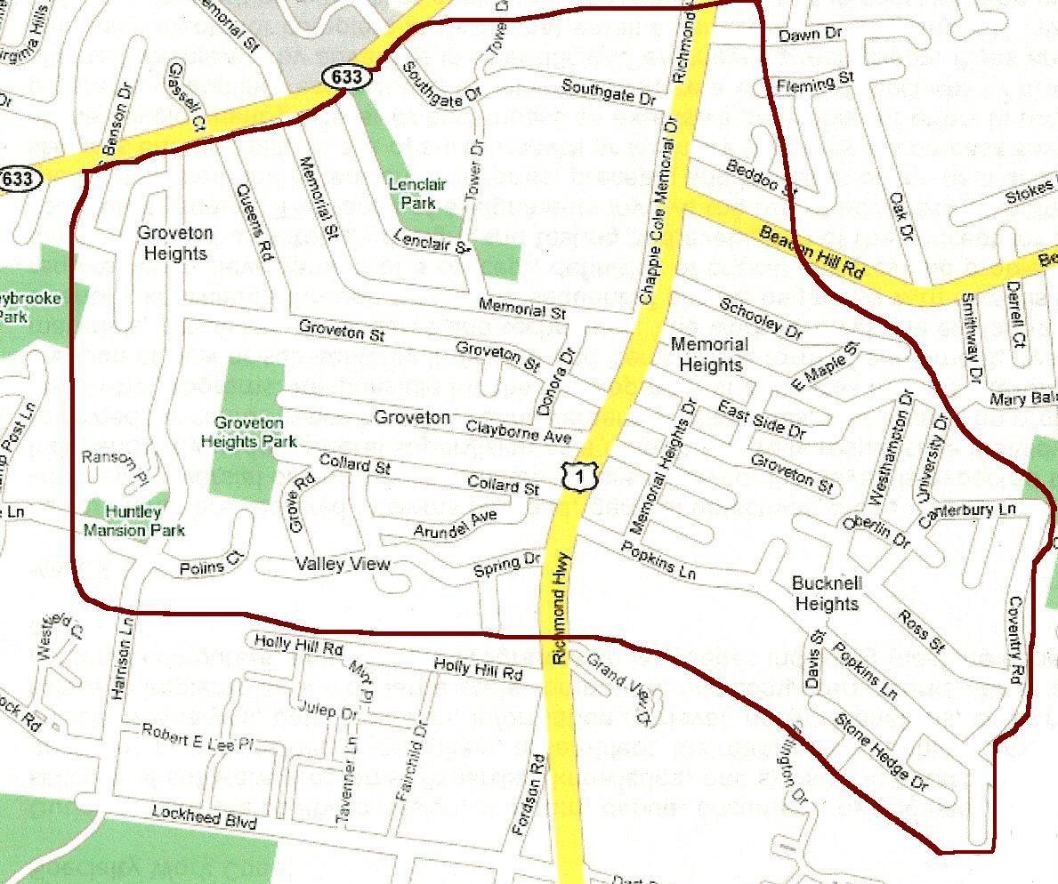
The below Groveton boundary is based on the community's history and understanding of the original school districts:
> Beginning at the Groveton Baptist Church on Route 1 and extending south about .8 miles to the crest of Route 1 (past Popkins Lane and before Holly Hill Lane).
> East from Beacon Hill Road, using an imaginary line to the end of Schooley Drive, Westhampton Drive, University Drive, and Canterbury Lane.
South from the end of Canterbury Lane down Coventry Road to the end of Popkins Farm Road.
> West from the end of Popkins Farm Road, using an imaginary line to Route 1.
> From Route 1, continue west on Holly Hill Road using an imaginary line across Harrison Lane, from Huntley Mansion Park to the east boundary line of the subdivision now known as Stoneybrooke and running parallel to Lamp Post Lane to a point south of the end of the streets known as Amlong Avenue, Benson Drive and Tahalla Drive where an imaginary line runs parallel to South Kings Highway then along this line to its junction with South Kings Highway.
Northeast from Tahalla Drive on South Kings Highway past Southgate Drive (across from the Mount Comfort Cemetery).
> Using an imaginary line from the intersection, of Southgate and Mount Comfort continue east back to the original point of entry on Route 1 at Groveton Baptist Church.
These boundaries were based on early surveys where the Paul Springs Branch ran to the east of Groveton in Hollin Hills and Darrell Springs was to the west of Route 1 in Groveton. Both springs flow to Little Hunting Creek, which continues to the Huntley Meadows Park and Mansion Park